Parel: Difference between revisions
No edit summary |
No edit summary |
||
| Line 7: | Line 7: | ||
Parel was one of the seven islands of Bombay, during 13th century was part of the Raja Bhimdev Kingdom and later was ceded by the Portugese to the British in the year 1661. At the time of the cession of the islands, Jesuits were the sole possessors of Parel along with Wadala and Sion. Edwardes(1909) mentions that in early eighteenth century, at Parel existed the Koli hamlets and were named Bhowada, Pomalla and Salgado. Thus Parel constituted of three hamlets. Parel also was known for its rice fields which later got defined as Salt Batty lands. | Parel was one of the seven islands of Bombay, during 13th century was part of the Raja Bhimdev Kingdom and later was ceded by the Portugese to the British in the year 1661. At the time of the cession of the islands, Jesuits were the sole possessors of Parel along with Wadala and Sion. Edwardes(1909) mentions that in early eighteenth century, at Parel existed the Koli hamlets and were named Bhowada, Pomalla and Salgado. Thus Parel constituted of three hamlets. Parel also was known for its rice fields which later got defined as Salt Batty lands. | ||
Name Parel seems to derive from the tree Paral (Heterophragma chelonoides) or Padal (Bignonia suaveolens) or from sans Pareil(the in-comparable). | Name Parel seems to derive from the tree Paral (Heterophragma chelonoides) or Padal (Bignonia suaveolens) or from sans Pareil(the in-comparable). The earlier inhabitants of Parel were the Panchkalshis, who called themselves as somavanshi kshattriyas and they build temples to their family deities-Wageshwari and Chandika and to Mahadeo. The other community that made Parel their home was Thakurs, who have a area known as Thakurwadi and worked as petty military officials. Also lived here were Kunbis (soil workers) and Dheds(porters) | ||
The islands of Parel and Mahim were separated by a marshland and they were joined in together by reclaiming the area in-between during the late eighteenth century and formed the areas that were later known as Dadar and Prabhadevi. The areas between Parel and Worli were reclaimed as part of the Hornby Vellard project during the same time. | The islands of Parel and Mahim were separated by a marshland and they were joined in together by reclaiming the area in-between during the late eighteenth century and formed the areas that were later known as Dadar and Prabhadevi. The areas between Parel and Worli were reclaimed as part of the Hornby Vellard project during the same time. In 1872 Parel was included in Ward E of the municipal corporation along with Mazagon, Tardeo, Kamathipura and Sewri and the area recorded of Parel at that time is 552 acres. | ||
As per the 1906 census, Parel had a population of 47,000 with a density of 85 per acre and compared to the 1872 Census had shown a population increase of 241%. In 1907-08, the land prices ranged from Rs 15 to 30 per sq. yard. | |||
The second major phase of reclamations started in 1772 for filling in the shallows between the islands of Parel, Worli, Bombay, Mahim and Mazagaon, by building a bund to prevent the ingress of the sea, thus gaining valuable land and stopping flooding of central Mumbai. This also connected Mahalaxmi and Worli in the process. This phase also involved the project of connecting the islands by sealing the Great Breach (Breach Candy) between Dongri, Malabar hill and Worli; initiated in 1784 by William Hornby then governor of Bombay presidency | The second major phase of reclamations started in 1772 for filling in the shallows between the islands of Parel, Worli, Bombay, Mahim and Mazagaon, by building a bund to prevent the ingress of the sea, thus gaining valuable land and stopping flooding of central Mumbai. This also connected Mahalaxmi and Worli in the process. This phase also involved the project of connecting the islands by sealing the Great Breach (Breach Candy) between Dongri, Malabar hill and Worli; initiated in 1784 by William Hornby then governor of Bombay presidency | ||
| Line 33: | Line 34: | ||
"Third Grant".- Third Grant was made in 1885 to Khan Bahadur Jamshedji Wadia at the time of completion of 40 years service in His Majesty's Dockyards. | "Third Grant".- Third Grant was made in 1885 to Khan Bahadur Jamshedji Wadia at the time of completion of 40 years service in His Majesty's Dockyards. | ||
Parel Workshop was setup during the period between 1877-79, spread across 43 acres of land. During the First World War the railway workshop was used to manufacture grenades, explosive shells and armoured cars for military. | |||
In 1853, the first electric circuit was established in Bombay in the form of telegraph communication between the Secretariat and Government House, Parel. (Edwardes, 1909) | |||
Great India Peninsula Railway (GIPR) Parel Workshop was setup during the period between 1877-79, spread across 43 acres of land and employed 7400 workers, 2 work managers and 28 European foremen. During the First World War the railway workshop was used to manufacture grenades, explosive shells and armoured cars for military. | |||
Bombay's first Cotton Mill started in the year 1854 at Parel called Oriental Spinning and Weaving Company by Cowasji Nanabhoy Davar. | Bombay's first Cotton Mill started in the year 1854 at Parel called Oriental Spinning and Weaving Company by Cowasji Nanabhoy Davar. | ||
In 1894 a flour mill was established at Parel by the name Union Flour Mill. It had an annual production of 24,000 tonnes and a part of it was sent to Africa and Burma; while the wheat was procured from Northern India. | |||
According to historian Rajnarayan Chandavarkar, from the later nineteenth century onwards, Parel village emerged as part of a distinct working class neighbourhood as cheaper land was available here for the setting up Mills as well as residences for the workers. | According to historian Rajnarayan Chandavarkar, from the later nineteenth century onwards, Parel village emerged as part of a distinct working class neighbourhood as cheaper land was available here for the setting up Mills as well as residences for the workers. | ||
Revision as of 13:47, 3 October 2017
Parel was one of the seven islands of Bombay, during 13th century was part of the Raja Bhimdev Kingdom and later was ceded by the Portugese to the British in the year 1661. At the time of the cession of the islands, Jesuits were the sole possessors of Parel along with Wadala and Sion. Edwardes(1909) mentions that in early eighteenth century, at Parel existed the Koli hamlets and were named Bhowada, Pomalla and Salgado. Thus Parel constituted of three hamlets. Parel also was known for its rice fields which later got defined as Salt Batty lands. Name Parel seems to derive from the tree Paral (Heterophragma chelonoides) or Padal (Bignonia suaveolens) or from sans Pareil(the in-comparable). The earlier inhabitants of Parel were the Panchkalshis, who called themselves as somavanshi kshattriyas and they build temples to their family deities-Wageshwari and Chandika and to Mahadeo. The other community that made Parel their home was Thakurs, who have a area known as Thakurwadi and worked as petty military officials. Also lived here were Kunbis (soil workers) and Dheds(porters) The islands of Parel and Mahim were separated by a marshland and they were joined in together by reclaiming the area in-between during the late eighteenth century and formed the areas that were later known as Dadar and Prabhadevi. The areas between Parel and Worli were reclaimed as part of the Hornby Vellard project during the same time. In 1872 Parel was included in Ward E of the municipal corporation along with Mazagon, Tardeo, Kamathipura and Sewri and the area recorded of Parel at that time is 552 acres. As per the 1906 census, Parel had a population of 47,000 with a density of 85 per acre and compared to the 1872 Census had shown a population increase of 241%. In 1907-08, the land prices ranged from Rs 15 to 30 per sq. yard.
The second major phase of reclamations started in 1772 for filling in the shallows between the islands of Parel, Worli, Bombay, Mahim and Mazagaon, by building a bund to prevent the ingress of the sea, thus gaining valuable land and stopping flooding of central Mumbai. This also connected Mahalaxmi and Worli in the process. This phase also involved the project of connecting the islands by sealing the Great Breach (Breach Candy) between Dongri, Malabar hill and Worli; initiated in 1784 by William Hornby then governor of Bombay presidency
The Project consisted of building a seawall blocking the Worli creek to prevent the low-lying areas of Bombay from being flooded at high tide and thus make reclamation possible, the project was started in the year 1782 and finished in 1845. The present day Ganpatrao Kadam Mark was earlier called Fergusson Road that connected Parel to Worli and was built by 1884.
It was one of the first major engineering projects aimed at transforming the original seven islands of Bombay into a single island with a deep natural harbour. The project was started by William Hornby (d.1803) during his governorship of Bombay from 1771-1784. The initiative was carried out against the wishes of the Directors of the Honourable East India Company (HEIC), but to great acclaim by the local inhabitants as it transformed the geography of the islands by opening up the marshy areas of Mahalaxmi and Kamathipura for habitation.
The primary purpose of the causeway was to block the Worli creek and prevent the low-lying areas of Bombay from being flooded by the sea. The causeway formed a crucial connection between north and south Bombay, thereby consolidating the central portion of the island thereby uniting the land north between Mahim and West Parel with the area south of Worli which was normally flooded at high tide.
The word vellard appears to be a local corruption of the Portuguese word vallado meaning 'barrier' or 'embankment'. All the Bombay islands were finally linked by 1838.
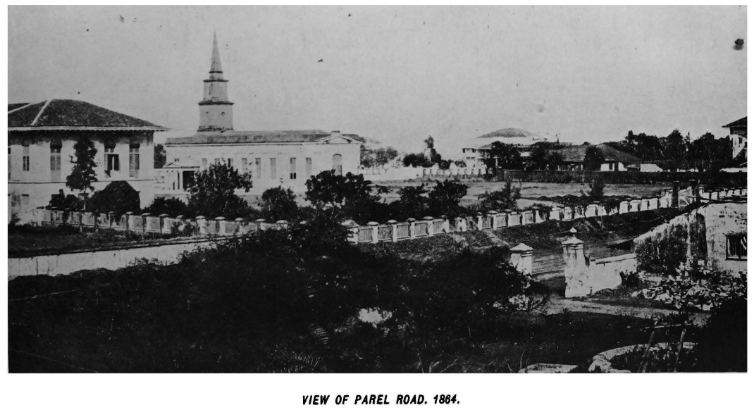
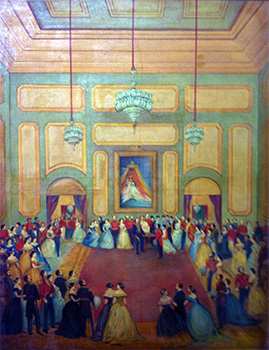
During the period 1770 and 1880 it was the seat of British power as the official residence of Bombay's Governor was situated there and was called 'Government House' which earlier housed a Jesuit seminary. A claim also is that the House was built at the site of the old temple of Parli Vaijnath from which Parel village got its name. Another account goes that it gets its name from Padel, marathi for the trumpet flower tree. Post 1880, Governor's residence was shifted to Malabar hill. In 1898, after the outbreak of plague, the House was converted into a plague research laboratory and handed over to Dr Waldemar Mordecal Haffkine and from him got its present name. Before that in year 1875, Prince of Wales visited it and a Darbar Hall was constructed to mark his visit.
Parel village was governed under Inami tenure under which the holder paid no assessment to Government of India or cess of any kind. The (inami) grants were paid to Lowji (Wadia) families in 1783, 1821 and 1885.
"First Grant".- In 1783, Sir Edward Huges, K. B.. Commander-in-Chief of His-Majesty"s Ship in India, brought to the notice of the Government the very important service rendered by the Parsi Master-builder, Maneckji and Bamonji Lowji Wadia and their two sons in refitting His-Majesty's Squandron and recommended a grant to the family of Lowji so long as they should continue in the service of the Company (East India Company), as Master- builders, a portion of the Company's batty grounds producing a net income of forty Mudas of batty annually.
"Second Grant".- Second Grant was made in 1821 and Jamshedji Bamonji Wadia (also a Master-builder in the Dockyards) was given batty-grounds of villages of Parel, Naigaon, Sion, Kasba of Mahim.
"Third Grant".- Third Grant was made in 1885 to Khan Bahadur Jamshedji Wadia at the time of completion of 40 years service in His Majesty's Dockyards.
In 1853, the first electric circuit was established in Bombay in the form of telegraph communication between the Secretariat and Government House, Parel. (Edwardes, 1909)
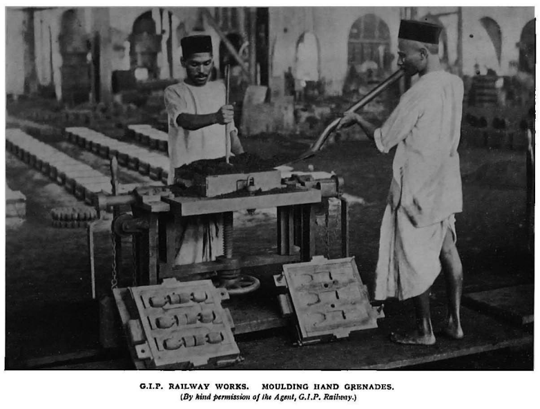
Great India Peninsula Railway (GIPR) Parel Workshop was setup during the period between 1877-79, spread across 43 acres of land and employed 7400 workers, 2 work managers and 28 European foremen. During the First World War the railway workshop was used to manufacture grenades, explosive shells and armoured cars for military. Bombay's first Cotton Mill started in the year 1854 at Parel called Oriental Spinning and Weaving Company by Cowasji Nanabhoy Davar.
In 1894 a flour mill was established at Parel by the name Union Flour Mill. It had an annual production of 24,000 tonnes and a part of it was sent to Africa and Burma; while the wheat was procured from Northern India.
According to historian Rajnarayan Chandavarkar, from the later nineteenth century onwards, Parel village emerged as part of a distinct working class neighbourhood as cheaper land was available here for the setting up Mills as well as residences for the workers. According to historian Prashant Kidambi the dwellings available for the housing needs of the labouring poor in the city varied in character from the single-room tenements known as chawls to the ‘zavli’ sheds constructed of dry leaves from date or coconut palms. Chawls or tenements consisting usually of single rooms were the predominant form of working-class dwelling and were to be found in Byculla, Khetwadi, Girgaum, Mahalakshmi,Tarwadi, Parel and Worli. These differed in appearance, construction and size.
During the 1946 RIN Mutiny, Parel was hotbed of support activities by the Mill workers to the striking navy. During one such morcha, 300 workers died when they were open fired upon at Elphinstone Bridge. Again during the Samyukat Maharashtra Movement in late 1950s and early 1960s Parel was one of the important site of mobilisation.
The Toka tenure system governed the lands at Parel Village and 'toka' referred to a share of the produce that was to be paid by the cultivators to the rulers. Toka lands were also described as 'Sweet Batty' grounds. The payment used to be in kind and during early 18th century into was converted into a money payment. Kunbis caste members were the ones who engaged in agriculture on these lands. In 1800, the system of payment either in cash or in kind was restored. Then the rate prescribed was Rs 23 per muda (one muda was equal to 25 maunds of rice). (source: The Gazetteer of Bombay City and Island Vol. II, 1909)
Parel's character and landscape changed twice during a period of one hundred years, first due to the setting up of mills and second time due to the closing of the same.
Mills in Parel: Jam Mill Tata Mill Digvijay Mill India United Mill Finlay Mill Western India Bombay Dyeing Swan Mill Standard Mill
Mills In General:
Bharat Mills China/Standard Mill Dawn Mills Elphinstone Mills Hindoostan Spinning and Weaving Mills India United Mills Jupiter Mills Kamala Mills Kohinoor Mill Khatau Mills Kurla/Swadeshi Mills Matulya Mills Modern Mills Morarjee Mill New Great Eastern Mills Phoenix Mill Piramal Spinning and Weaving Mill Raghuvanshi Mills Shree Ram Mills
Links:
DCR 58
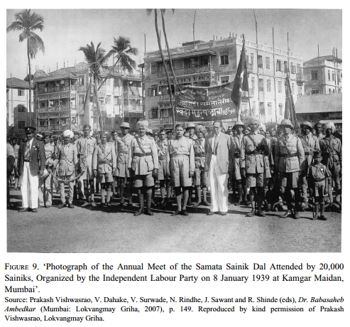
Ambedkar in Parel: According to Anupama Rao, Central Bombay including Bombay was 'Dalit Bombay'

