Difference between revisions of "Maps 1700 to 1950"
| Line 17: | Line 17: | ||
File:1853_bombay_Salt_Batty_lands.jpg|1853 Salt Batty Lands | File:1853_bombay_Salt_Batty_lands.jpg|1853 Salt Batty Lands | ||
File:OutlineIslands_1854_1.jpg|Outline of Bombay, Trombay and Salsette by De Lisle 1854 | File:OutlineIslands_1854_1.jpg|Outline of Bombay, Trombay and Salsette by De Lisle 1854 | ||
| + | File:OutlineIslands_1854_2.jpg|Outline of Bombay, Trombay and Salsette by De Lisle 1854 | ||
| + | File:OutlineIslands_1854_4Northwest.jpg|Outline of Bombay, Trombay and Salsette by De Lisle 1854 | ||
| + | File:OutlineIslands_1854_5North.jpg|Outline of Bombay, Trombay and Salsette by De Lisle 1854 | ||
| + | File:OutlineIslands_1854_6Northfar.jpg|Outline of Bombay, Trombay and Salsette by De Lisle 1854 | ||
| + | File:OutlineIslands_1854_7section.jpg|Outline of Bombay, Trombay and Salsette by De Lisle 1854, Section from Vihar Lake to Fort | ||
| + | File:OutlineIslands_1854_8South.jpg|Outline of Bombay, Trombay and Salsette by De Lisle 1854 | ||
| + | File:OutlineIslands_1854_9index.jpg|Outline of Bombay, Trombay and Salsette by De Lisle 1854 | ||
File:1884 Tulsi Pipe Map.png|Tulsi Pipe from Tulsi Vihar Lake to Malabar Hill 1884 | File:1884 Tulsi Pipe Map.png|Tulsi Pipe from Tulsi Vihar Lake to Malabar Hill 1884 | ||
File:1885 Bombay Harbour.jpg|1885 Bombay Harbour | File:1885 Bombay Harbour.jpg|1885 Bombay Harbour | ||
Latest revision as of 19:56, 19 July 2019
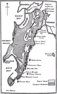
Map of Bombay 1660
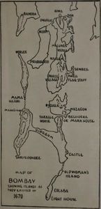
Map of Bombay 1670
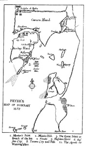
Fryer's Map of Bombay 1672
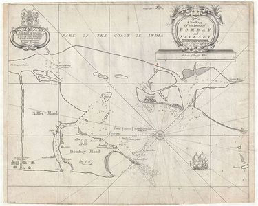
Bombay Map 1710
Thornton Map of Bombay and Salsette 1711
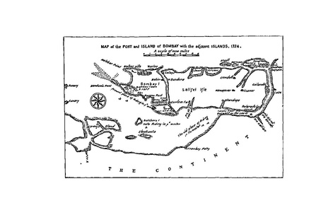
Bombay Port and Island 1724
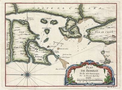
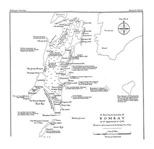
Bellin Map of Bombay 1750
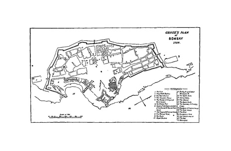
Grose's Map of Bombay 1750
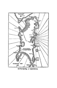
Niebuhr Map of Bombay 1764
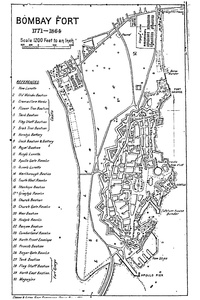
Bombay Fort 1771-1864
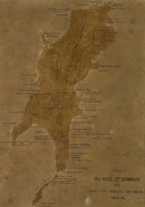
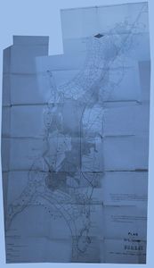
Dickinson Survey 1812-16
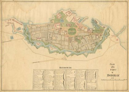
Map of Bombay Fort 1840
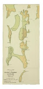
Murphy's Map of Island of Bombay and Colaba 1843
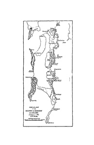
Murphy's Map of Bombay 1843
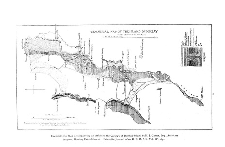
Geological Map of Bombay Island 1852
1853 Salt Batty Lands
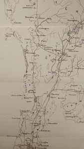
Outline of Bombay, Trombay and Salsette by De Lisle 1854
Outline of Bombay, Trombay and Salsette by De Lisle 1854
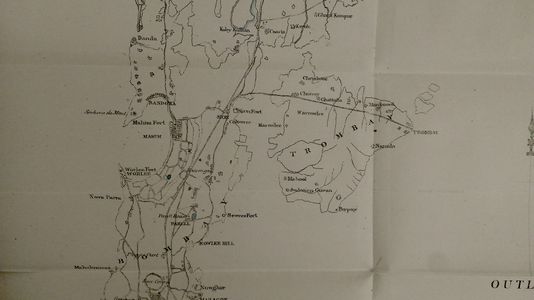
Outline of Bombay, Trombay and Salsette by De Lisle 1854
Outline of Bombay, Trombay and Salsette by De Lisle 1854
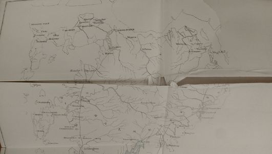
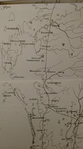
Outline of Bombay, Trombay and Salsette by De Lisle 1854
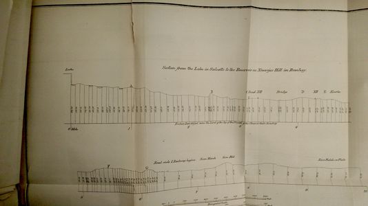
Outline of Bombay, Trombay and Salsette by De Lisle 1854, Section from Vihar Lake to Fort
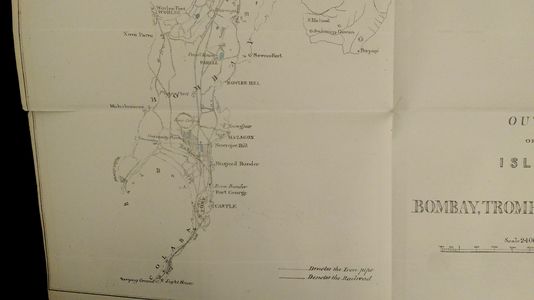
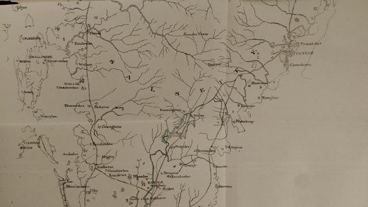
Outline of Bombay, Trombay and Salsette by De Lisle 1854
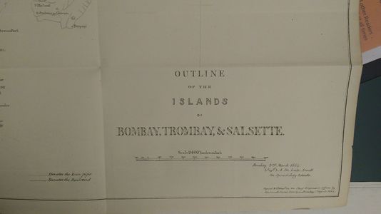
Outline of Bombay, Trombay and Salsette by De Lisle 1854
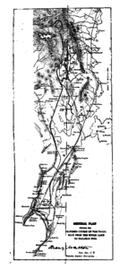
Tulsi Pipe from Tulsi Vihar Lake to Malabar Hill 1884
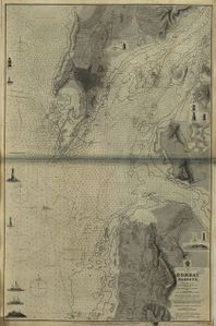
1885 Bombay Harbour
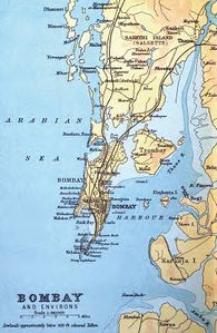
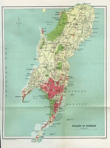
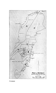
1893 Bombay Island and Salsette
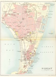
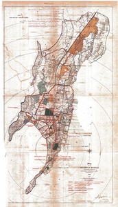
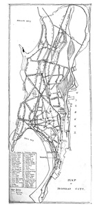
Map of Bombay 1893
1895 Bombay Island TOI Map
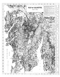
Salsette 1896
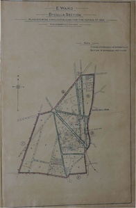
Byculla 1901
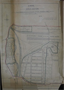
Dongri 1901
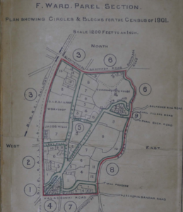
Parel 1901
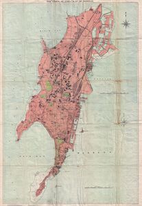
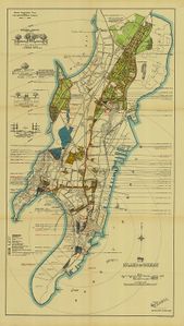
Bombay Island City 1909
Salsette 1913
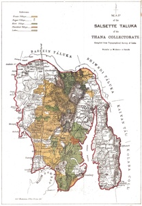
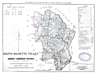
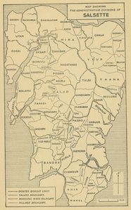
Salsette Taluka 1913
Map of Bombay Island City 1915
Bombay City 1919
Bombay City Survey 1914-1918
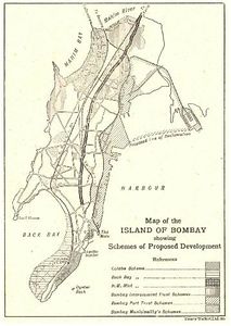
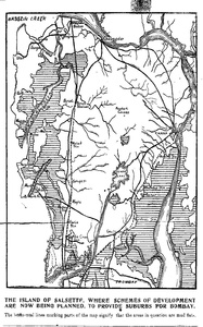
Schemes of Proposed Development 1919
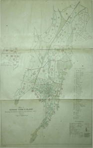
Bombay Town and Island City Census Divisions 1921
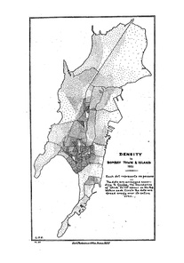
Densities of Bombay Town and Island 1921
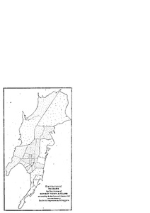
Beggars in Bombay Town and Island City 1921
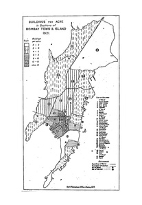
Buildings Per Acre in Bombay Town and Island City 1921
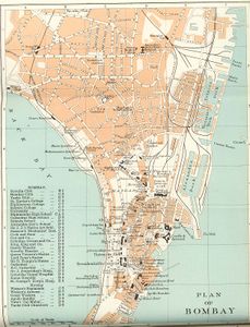
Plan of Bombay 1924
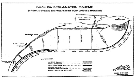
Back Bay Reclamation Scheme Progress upto 1925
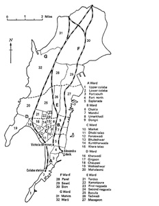
Map of Bombay showing Wards 1928
South Salsette 1929
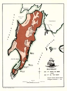
Bombay 1660 to 1930
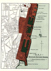
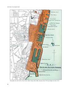
Bombay Port Trust Docks and Bunders 1930
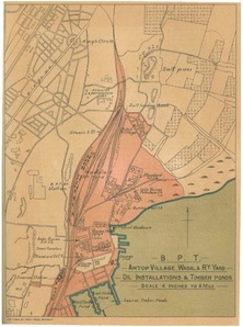
Antop Hill-BPT 1930
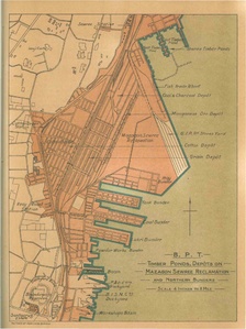
Mazgaon Sewri Reclamation 1930
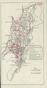
1933 Bombay Island City
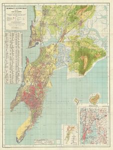
Bombay Guide Map by Survey of India 1933
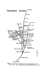
Tramways System 1936
Bombay City 1941
Bombay Island City 1945
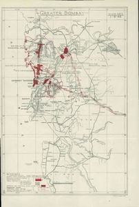
Greater Bombay 1945
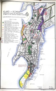
Island City as Part of Mayer-Modak Plan 1949
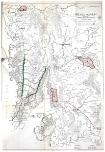
Greater Bombay Plan of Mayer-Modak 1949
Bombay Docks
Salsette Village Map 1950


