Maps 1700 to 1950: Difference between revisions
Jump to navigation
Jump to search
No edit summary |
No edit summary |
||
| Line 3: | Line 3: | ||
File:1711 Thornton Map of Bombay and Salsette.jpg|Thornton Map of Bombay and Salsette 1711 | File:1711 Thornton Map of Bombay and Salsette.jpg|Thornton Map of Bombay and Salsette 1711 | ||
File:1750 Bellin Map of Bombay.jpg|Bellin Map of Bombay 1750 | File:1750 Bellin Map of Bombay.jpg|Bellin Map of Bombay 1750 | ||
File:1771-1864 Bombay Fort.pdf|Bombay Fort 1771-1864 | |||
File:1812 Bombay Map Dickinson Survey.jpeg|Dickinson Survey 1812-16 | File:1812 Bombay Map Dickinson Survey.jpeg|Dickinson Survey 1812-16 | ||
File:1840 Map of Bombay Fort.jpg|Map of Bombay Fort 1840 | File:1840 Map of Bombay Fort.jpg|Map of Bombay Fort 1840 | ||
Revision as of 13:50, 15 December 2017
-
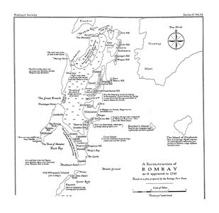 Bombay Map 1710
 -
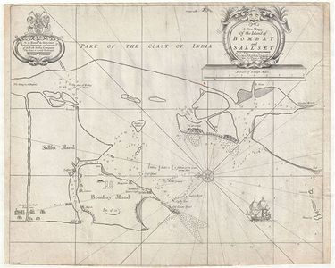 Thornton Map of Bombay and Salsette 1711
 -
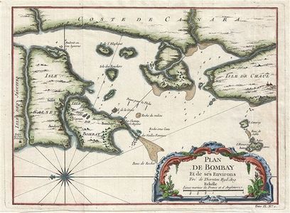 Bellin Map of Bombay 1750
 -
 Bombay Fort 1771-1864
 -
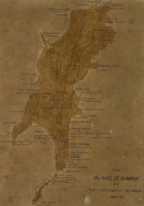 Dickinson Survey 1812-16
 -
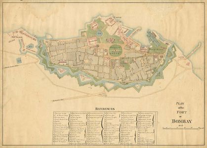 Map of Bombay Fort 1840
 -
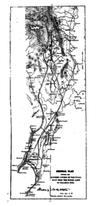 Tulsi Pipe from Tulsi Vihar Lake to Malabar Hill 1884
 -
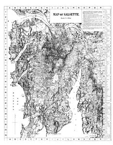 Salsette 1896
 -
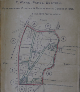 Parel 1901
 -
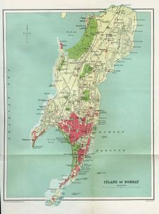 Bombay Island City 1909
 -
Bombay Town and Island City Census Divisions 1921
-
Densities of Bombay Town and Island 1921
-
Beggars in Bombay Town and Island City 1921
-
Buildings Per Acre in Bombay Town and Island City 1921
-
South Salsette 1929
-
Bombay Island City 1945
-
Greater Bombay 1945
-
Island City as Part of Mayer-Modak Plan 1949
-
Greater Bombay Plan of Mayer-Modak 1949


